Is land surveying carried out if a cadastral passport was previously issued?
Content
The land surveying procedure involves determining the boundaries of a land plot and drawing up a document documenting the results of work carried out on the site. Land surveying is not required if there is a cadastral passport. Except in cases where there is no information about boundaries, and the owner does not intend to sell, bequeath or lease the land.
delineation is carried out on various plots of land: state, municipal, private, having different purposes. The procedure is universal and mandatory for everyone. The presence of old cadastral passports only in some cases exempts owners from performing this operation.
What does the law say?
The main document in force in the field of land use is the Land Code of the Russian Federation. It recommends paying attention to Chapter I.1 “Education of land plots”, in particular:
- Art. 11.4 - rules for dividing a plot: land owned by a private individual, organization, municipality or state can be divided. In this case, the previous plot ceases to exist, and in its place several new ones appear, belonging to the same owner. If a plot of land is owned by several persons, then after division the common property remains. An exception is the conclusion of an agreement that determines which of the plots will belong to each owner;
- Art. 11.5 - allocation: implies the preservation of the previous land plot as an object, but its reduction by separating another from it. Allocation is used in shared ownership, when other co-owners receive their own separate plots. In this case, they lose the right to the main plot;
- Art. 11.6 - merger: as a result of the merger, the allotment is enlarged. The areas included in its composition cease to exist, and one large object is formed, which has its own boundaries. The right of shared ownership is retained unless the parties have provided for other conditions;
- 9 — requirements for sites. There are few of them: compliance with size limits, maintaining the possibility of using real estate located on plots, respecting the boundaries of settlements and municipalities.
Certain provisions are included in:
- Federal Law “On Cadastral Activities”, in particular, it contains the rules for conducting cadastral activities;
- Federal Law “On State Registration of Real Estate”. This document contains a lot of important information regarding the registration of ownership of the site and the requirements for documents;
- Town Planning Code.
The main thing that owners of land plots need to know: starting from 2018, they will not be able to dispose of it without a cadastral passport, which marks the milestones and turning points of their properties. To do this, you need to mark the boundaries of the site.
Should land surveying be carried out if there is already a cadastral passport?
Land surveying and a cadastral passport for a land plot are not the same thing. Moreover, before the introduction of new norms, they did not even imply each other. Currently the situation has changed.
Now, in order to obtain cadastral passports, land plots must establish boundaries, which is why land plots are surveyed. Previously, it was allowed to register documents for land without defining clear boundaries.
This situation simplified life for landowners, but did not exclude disputes between neighbors, self-seizure of other people's lands and other problems associated with encroachment on neighboring property.
See >> All the pros and cons of land surveying .
There are practically no plots of land that do not have cadastral passports. Usually these are new objects resulting from some action: selection, merger, section. They need to be registered again, receive a number and determine boundaries.
If land surveying has been carried out in relation to a site that has ceased to exist as a result of allocation, division, or merger, then the previous boundaries are invalid and new ones must be drawn up.
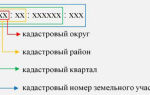
Cadastral passport (CP) is a document containing the characteristics of an object. He contains:
- date of inclusion of the site in the register;
- its description, location, area;
- coordinates on the map;
- type and category;
- details of title documents (those on the basis of which the owner acquired the property);
- the presence of easements or other encumbrances;
- turning points and demarcation lines;
- diagram and satellite view.
The listed information must be included in the new sample documents. Old cadastral passports that continue to be valid may only partially contain these items. Some even contain the line “borders are not defined.” Turning points are absent in almost all previously issued passports.
An additional argument for owners of old land documents are the processes occurring with the soil: erosion, self-capture, changes in river beds, as well as other human and natural circumstances that cause deformation of the site and its area.
An old document will not allow you to dispose of the land: bequeath, sell, lease. The ability to use it remains the same.
If the owner has a plot of land with an old cadastral passport, then he can independently or with a specialist determine:
- does it comply with legal requirements;
- Is it necessary to carry out land surveying if there is already a cadastral passport.
A notary or lawyer will analyze the documents, correlate them with current legal norms, and give an opinion regarding the need to carry out the land surveying procedure.
Getting a consultation is easy: just ask a question online in the consultant’s window or in the comments.
How to carry out land surveying: procedure and documents
The procedure precludes carrying it out independently, so in any case you will have to contact specialists who have received a license for geodetic and cartographic activities and carry out land surveying work.
More details here >> List of documents for land surveying .
Structurally, there are several stages:
Stage 1. Preparation of documentation: certificate of ownership or extracts from the Unified State Register of Real Estate, an agreement or other act on the basis of which the land was acquired, the owner’s passport, a power of attorney if a representative is acting.
Stage 2. Selecting an organization or individual entrepreneur and signing a contract for work. A cadastral engineer can work independently as an individual entrepreneur or on the staff of a company. A license is required!
Stage 3. Direct work on land surveying. The work includes a whole range of activities:
- obtaining information about the site from documents, analyzing the addresses of neighbors;
- creation of a technical or boundary design that corresponds to the assignment for carrying out boundary work;
- notification of owners of adjacent plots about work;
- direct work on the site, including determining its boundaries (using existing marks or according to the owner), obtaining an act of approval of boundaries with neighbors;
- surveying and identifying the coordinates of boundary markers;
- area calculation;
- creating a drawing with boundaries;
- development of the final boundary plan.
Stage 4. Obtaining the result of the work. The boundary plan is drawn up in paper form, signed by the engineer who carried out the work, and sealed with the seal of the organization. In the electronic version, the plan is signed with a qualified digital signature.
Stage 5. Contact Rosreestr. Previously, issues related to land were dealt with by the Cadastral Chamber. Formally, it was abolished and its functions were transferred to this organization as a single body dealing with real estate. Therefore, the owner submits the boundary plan to Rosreestr in person, by mail or via the Internet.
You can find out the cost of land surveying services here .
Thus, surveying land boundaries and issuing a cadastral passport are the most important procedures for identifying a plot, allowing the owner to dispose of it.
Why carry out land surveying if the CP was drawn up earlier?
In answering the main question, it is necessary to make a reservation and note that surveying, if a cadastral passport has been issued, is not required for all holders of cadastral passports, but only for those whose such passports do not meet the new requirements.
Owners of old-style documents will not be able to dispose of the land, since such a transaction will not be registered with Rosreestr.
If a will, sale, or lease are not included in the owner’s plans, then the land plot does not need to be surveyed and a new passport is issued.
Land surveying is carried out on a paid basis. Its cost depends on the region and area of the plot; the larger it is, the higher the price. Determining the boundaries of a small plot will cost the owner several thousand.
Defining boundaries is required to exclude complaints from neighbors about the seizure of their land, or vice versa. Land disputes often end up in court. And as part of the trial, a paid survey procedure will still be carried out. Only it will be supplemented by other expenses that increase the total amount.
Thus, land surveying is not required for those owners whose documents already include information about boundaries, coordinates and other important information regarding the site.
Everyone else is advised to consult with specialists regarding the need for geodetic work. If land surveying has previously been carried out and a cadastral passport has been issued, then re-determination of boundaries is not necessary.