Crossing the boundaries of adjacent land plots - how to eliminate them?
Content
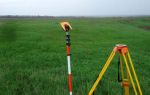
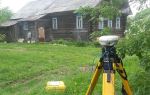
When carrying out cadastral registration processes and preparing documentation for land, it sometimes turns out that some of the boundaries of the site intersect with the outlines of the neighboring one. This problem is called “crossing land boundaries,” and many citizens naturally have a question: what to do? In fact, we can resolve the issue of identifying characteristic points, but most often we cannot do without the help of professional lawyers.
If you need to get advice from a lawyer or notary on land issues in Moscow, you can do this on our website - here . The specialist will carefully review the situation that has developed, and then advise on the best course of action. Also, if necessary, the lawyer will provide samples of documents that may be needed in the process of eliminating the problem with a previously recorded land plot.
Crossing borders - what does it mean?
Modern laws say that when an intersection is detected, cadastral registration should be immediately stopped for a while to determine the reasons for such a violation. Similar regulations are available in the cadastral Federal Law (clause 2, part 2, article 26), ratified on July 24, 2007.
There is one nuance here: the neighbor’s plot is a piece of real estate that is going through the stage of transformation.
Why does the crossing of plot boundaries occur?
It happens that the border of a land plot intersects the neighboring one. The solution to the problem is to eliminate the intersection. First you need to find out with maximum accuracy the causes of this phenomenon.
It happens that the cadastral engineer made a mistake, for example, the information in the cadastral passport and the real estate register about the boundaries does not match or is noticeably different from each other.
The problem is solved quite simply: the organization of territorial registration by cadastral authorities must itself make important changes. Obtaining results does not require time or financial costs. In addition, the owner of the plot may not participate in the process.
Things will be different if an error was made by a cadastral land surveyor while working on the site.
Federal Law Art. No. 28 part 4. says that in this case the error is resolved as follows:
- in the form of information, when documentation with erroneous information included in the state register is similar to papers that were sent to cadastral registration for interaction in the information field;
- if the papers with an error refer to documents specified in Federal Law Article 22 on the cadastre;
- on the basis of a court decision received by the plaintiff immediately after the court hearing on the case.
In the first two situations, the error that caused the intersection is eliminated out of court. Then the clarification of boundaries occurs exclusively through the court.
In the presented video, the author talks about typical situations for correcting errors when one border crosses another territory.
And here is the second part of the video, which examines the intersection of two or more sections:
How to challenge the crossing of land boundaries
If the rights of a land owner are violated, he can solve the problem without going to court, taking into account legislative norms and amendments to the Land Code that facilitate the interaction of landowners with government agencies. Otherwise, you should file a claim in court.
Without going to court
According to legislative acts, if it is necessary to correct a cadastral error in the event of erroneous information on a land plot recorded in the past, the registering authority must make a decision regarding the suspension of cadastral registration for a time.
To promptly eliminate the intersection, it is possible to draw up a boundary plan with information regarding the allotment being specified/created, and the location of the border of the land plot.
The boundary plan is accompanied by an act of approval of the location of the boundaries of land plots whose location contains errors. Experts say that if, when they are eliminated, the configuration or area within the boundaries of the registered area does not change, then the approval act will not be issued.
Through the court
Most often, it is not possible to peacefully resolve the problem when crossing the boundaries of a land plot, since land disputes have been waged by people for a long time, sometimes degenerating into hostility between several generations of neighboring families.
Coordination of the location of plot boundaries in court in most cases is associated with the neighbor’s disagreement with the specified outlines. Land disputes of this kind in court most often drag on for a long time, so it is worth being patient.
In order to challenge the location of the boundary of a land plot in court, you should carefully draw up a claim, indicating in it all the data related to the case.
After the court makes a decision in favor of the plaintiff, you need to contact the local cadastral registration authorities, which decided to suspend cadastral registration to eliminate the intersection problem. Cadastre specialists take into account whether the court decision for the site contains a boundary plan where the exact coordinates are indicated.
Therefore, for the further successful work of employees, it is important that the boundaries of two adjacent plots are included in the documentation, which will affect the rapid introduction of changes. Lawyers believe that when drawing up a claim, it is important to require that the correct geodetic data, position and coordinates of the plots be included in the court decision.
Corrected information undergoes state registration based on an application. It must be submitted to the State Real Estate Cadastre (GKN).
Examples from judicial practice
In 2000, citizen Alexander P. bought a plot of 8 acres near Dmitrov, after which he registered it with state registration (in accordance with Article 218 of the Federal Law). In 2006 and 2012 New certificates were received, the cadastral number and extract were changed. In 2013, in the “Special Notes” paragraph, the information “the boundaries of the site have not been established” was added. Alexander P. contacted the cadastral chamber, from where he received an official response from specialists: “the boundaries of the site have been restored,” and a recommendation was given to contact the cadastre. The cadastral extract from the Unified State Register states that “there is an intersection of plot boundaries.” What to do in this case?
Lawyer's answer: It is necessary to enter into correspondence to obtain information about which area the border crossing was observed with. It is necessary to appeal the cadastral registration of an allotment with which there is an intersection of the boundaries of citizen P.’s allotment, since land surveying of the plot belonging to him was carried out earlier. If a dispute arises regarding rights with the owner of a plot with problematic boundaries, in this case Alexander P. will have to recognize his ownership of the intersection area in court.
Igor N. has been using the plot since 1995 and registered ownership of it on the basis of a special extract from the business book. When the boundaries were clarified, it was discovered that they intersected with a neighboring plot, the rights to which were terminated by a court decision due to the invalidity of the title documentation. According to the cadastral extract, the boundaries of the neighbor's plot are not defined, but there are boundaries of its two parts with cadastral numbers. What to do: ask the court to remove the plot from cadastral registration or write a statement of claim to exclude data on the boundaries of the parts?
Lawyer's answer: If the delimitation of an adjacent plot is carried out incorrectly, if it is impossible to register the plot (cadastral registration), it is necessary to “correct the cadastral error”. The procedure is carried out by cadastral engineers.