Legal increase in land area
Content
The land reform, which began in 2015, was one of the first innovations that gave citizens the right to increase the area of their land plot at the expense of lands that are in municipal and state ownership. Despite the apparent simplicity of the procedure, in practice quite a lot of questions arise about how to legalize an increase in agricultural space in Moscow and other regions of the Russian Federation.
Therefore, the help of a specialist in preparing documents will come in handy. This will save not only time resources, but also reduce the cost of processing additional documents.
In what cases can the storage area be increased?
The legislator allows increasing the size of the loan in the following cases:
- information about the allotment is contained in the State Property Committee, that is, its boundaries are clarified;
- the area does not exceed the maximum value established by the rules of development and land use;
- empty land that is adjacent to the site and does not belong to anyone;
- the plot is intended for running a subsidiary or dacha farm, vegetable gardening or horticulture, individual housing construction in accordance with Art. 35. ZK RF.
Important! The newly formed land ownership should not exceed the minimum area of the main plot established by the rules of development and land use.
Redistribution of land plots is not allowed in the following cases:
- The memory does not comply with legal requirements;
- an independent unit can be formed from the attached plot;
- there is a discrepancy between the type of permitted use of the site and the territorial zone of its location.
List of documents for site expansion
It is necessary to increase the area of the site in compliance with the algorithm of actions:
- We order a layout diagram of the main plot from a cadastral engineer. The added plot is located in the same cadastral block and territorial zone as the main one.
- An application for an increase in area, a land plan and a title document for it must be submitted to the authorized government body that deals with issues of granting plots.
- After reviewing the submitted documents, the authorized body makes a decision on the increase.
- The applicant must again contact the cadastral engineer in order to obtain a boundary plan for the new plot, which was obtained through redistribution. In turn, the cadastral engineer redirects the plan to the Cadastral Chamber to register the plot of land for cadastral registration.
- As a result, the citizen is issued a cadastral passport, which he submits to the authorized body for drawing up a redistribution agreement. It is this document that will be the basis for registering ownership of the new, merged land plot.
Important! The plot that is being annexed must have restrictions that will not allow it to be turned into an independent plot. We can talk about area, location. Otherwise, redistribution will be denied.
The procedure for increasing the area of land
Increasing the boundaries of a land plot is possible in several ways, each of which is suitable for a specific situation. Below we will consider each case in more detail.
When clarifying the boundaries
Clarifying the boundaries of a land plot with an increase in area is a legal procedure for changing the boundaries of a plot by adding a new space. In practice, these works are carried out by a cadastral engineer and are called “Registration of additions” on the basis of Federal Law No. 171-FZ dated June 23, 2014.
Read also >> How to register an addition to a land plot .
Reasons for the procedure:
- owner's desire;
- availability of vacant land adjacent to the plot;
- lack of land surveying.
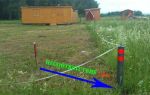
The boundaries are clarified through land surveying , which will increase the area of the site due to abandoned lands by 10% of the area of the main plot.
When surveying
Increasing the boundaries of the plot with the help of land surveying involves changing the area by moving the boundaries of the plot to a free area.
Read also >> How dacha plots are surveyed https://migrant66.ru/zemlya/mezhevanie/mezhevanie-dachnyh-uchastkov.html .
It is important to meet 2 conditions:
- the land that is annexed must be vacant;
- the annexed plot must match the main one in terms of the type of permitted use and category of land use.
Important! The annexed plot must not exceed the established minimum size established by land use regulations. Municipalities determine the area independently. But if there is no such regulatory act, then the annexed plot cannot exceed the area of the main one by more than 10 percent - the law in this regard is quite clear and does not allow errors.
When surveying, an act must be drawn up that reflects the consent of all interested parties. The approval procedure must be followed; otherwise, such an increase can be considered illegal (Federal Law No. 218-FZ dated July 13, 2015).
For reference! The title actually remains the same: the cadastral number does not change; but changes are made to the state register information about the land plot regarding the specified land plot.
Through redistribution
An increase in the area of the plot must be formalized by a redistribution agreement, which is concluded between the owner of the main plot and the local government body, which has the right to dispose of municipal land.
Algorithm of actions:
- The owner of the neighboring plot clarifies who is the owner of the plot that is planned to be annexed. This may be federal, municipal or regional land; with private property such a procedure is impossible.
- The citizen submits an application to the authorized body.
- The following documents are attached to the application:
- confirming ownership of the property;
- land layout diagram, etc.
- Within a month, the authority makes a decision on concluding an agreement or refusing to sign the document, justifying the reasons for the refusal.
- If a positive decision is made, then the owner, at his own expense, carries out land surveying to clarify the boundaries and puts the site on cadastral registration. Only after this the agreement is signed. It is the agreement that serves as the document for registering ownership rights to the property.
Important! Only those plots can be redistributed from which new plots cannot be formed.
By 10 percent or more
An increase in the boundaries of a land plot during the dacha amnesty is allowed by no more than 10%, if the previously specified boundaries were not determined in the manner prescribed by the legislative act of the Russian Federation.
The authorized body has the right to refuse state registration in connection with clarification of the boundaries of the property for the following reasons:
- the area of the newly formed site has become larger than the value specified in the title documents by the minimum approved size specified in the regulatory act of the local government body;
- When clarifying boundaries, the order of boundary approval was violated.
Payment amount
The amount of payment for increasing the area of a plot that is privately owned by annexing lands from federal property is specified by Decree of the Government of the Russian Federation dated December 3, 2014 No. 1308 and is set at 15% of the cadastral value of the plot . The cost is calculated in proportion to the part to be connected.
As for lands owned by municipalities, regional local governments set fees for increasing the area of land plots by adopting a regulatory act.
Consideration of typical situations
Let's look at a few examples from practice.
- After the death of her father, the daughter inherited 6 acres in the village. But after taking measurements a couple of years later, it turned out that the area of the site was 2.69 acres larger. How to apply for an increase in the dacha amnesty?
First, we get the consent of the neighbors, then we go to the administration and find out whose land it is. Next, we clarify the maximum size of the area change, which is established by the local government, after which we carry out land surveying. We register the plot of land with the cadastral register and receive a cadastral passport. After this, we submit the documents to the district administration and conclude an agreement on redistribution.
- I. decided to annex the abandoned plot to his allotment. He obtained permission from neighbors, drew up a map of the site and applied for its registration. However, difficulties arose due to the fact that the site, although abandoned, was owned by the administration. I. decided to buy it out and approached the authorized body with an offer. He was provided with all the characteristics of the site and named the price. He paid it and received the land. Next, land surveying was carried out to clarify the boundaries, after which I. applied to the authorized body to register the received plot.
Thus, increasing the area of the land plot is possible by attaching a free plot to it. In this case, it is necessary not only to follow the procedure established by law, but also to clarify whether the allotment can really be annexed.


 (votes: 3, average rating: 3,67 out of 5)