What to do when imposing the boundaries of a land plot?
Content
If there is an overlap between the boundaries of neighboring land plots, then the boundary of the land should be clarified, otherwise operations with it are impossible: sale, lease, or other use will lead to a dispute between neighbors regarding the area of their plots.
What is meant by imposing the boundaries of a land plot?
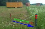
Boundary overlap is the intersection of the boundary lines of two or more adjacent properties. The overlap on a previously recorded area can be factual when it comes to natural boundaries and formal, found in documents.
The first case involves the seizure of part of a neighboring plot belonging to another owner. Its reason is the unauthorized transfer or establishment of boundaries without land surveying.
The second type of imposition has more complex reasons associated with calculations indicating the need to move the boundaries of the site towards someone else's land. The reasons are:
- incorrect measurements;
- erroneous calculations during land surveying;
- error when entering data into the registry;
- landscape change.
The fact is that at the stage of approving the boundary plan at the cadastral authority, if an error is identified, employees can make adjustments that are not always correct and will ultimately lead to the imposition of the boundaries of the site. This error is harder to find than all the others.
Read also >> Examples of errors in the cadastre .
Problems can also arise when the boundaries of the site are tied to landscape elements, which tend to change, dragging along the boundary lines.
Why do such situations arise?
Imposing boundaries in any case implies someone's mistake. All of them can be divided into two large groups:
- technical. Occur when entering data into a document: typos, replacement of numbers, typos and other inaccuracies that arise when filling out documents;
- cadastral, arising when the procedure for land surveying or cadastral registration is carried out incorrectly.
If an error is detected, all work on the site is suspended until it is eliminated, and the authorized body is informed about the failure in the boundary space.
According to the regulations, the error is corrected by State Tax Committee employees after it is discovered. To do this, an internal administrative document is drawn up, the basis for which is the owner’s statement about the found inaccuracy in defining the boundaries.
Read also >> Error resolution process .
Applications from individuals are not always considered and must be satisfied. When inaccuracies are implicit, consideration for forgiveness will be denied.
What to do to solve the problem
If during geodetic work it was discovered that the boundaries of the site overlap with the forest fund or another site, it is recommended:
- request an extract from the cadastral chamber to clarify the boundaries of the site;
- obtain a certificate of boundaries from the survey project;
- order a data recalculation from a cadastral engineer;
- get your neighbor's boundary plan.
After this and based on the information received:
- write a statement to correct an error related to the imposition of boundaries. The document is sent to the territorial office of Rosreestr or its branch;
- try to resolve the issue with your neighbor.
How to solve the existing problem depends on the nature of the error. You can receive an individual free consultation specific to your case. To contact a lawyer, you need to fill out the form on the website or call by phone.
Error in the cadastre
If the overlap of boundaries is the result of a cadastral error, then the owner should write an application to Rosreestr with a request to correct the error. Attached to it:
- copy of the passport;
- title document for the site (agreement and certificate, if any);
- discharge;
- a copy of the draft boundary plan in the part relating to boundaries;
- conclusion of the cadastral engineer on the boundaries;
- information about the engineer, including a copy of the license.
The application is considered within one month and changes are made to the cadastre or the owner receives a reasoned refusal.
Error during geodetic work
Such mistakes are not uncommon, so it is recommended to choose a specialist more carefully and attentively. To correct the overlap of adjacent land plots, an independent expert is hired to carry out a complete survey of the site again.
If the error is confirmed, the owner may demand compensation for losses caused by poor quality work in pre-trial and judicial proceedings.
Unauthorized seizure
How to correct an overlap that occurred when a neighbor moved the boundaries of a property:
- ask the neighbor to show a boundary plan or an extract from the cadastre indicating the boundaries;
- compare it with your data and contact Rosreestr with a request to correct the error;
- if a neighbor refuses to present documents, you need to carry out land surveying;
- notify your neighbor about the approval of boundaries at least 10 days before the meeting, setting the day and time for signing the act (it is acceptable to send a telegram with notification of receipt);
- draw up an agreement document;
- if you refuse further peaceful settlement, go to court.
Another option for resolving the conflict is to jointly conduct a land management examination. It costs less than surveying two plots, but as a result it will also allow you to establish the correct boundaries.
For unauthorized seizure of land, a fine of 5 thousand rubles is provided. It is recommended to warn your neighbor about this.
Landscape
Previously, turning points were tied to landscape elements, so when it changes, the boundaries move. Errors can be so serious that they cross the boundaries of areas located across two streets. Nowadays, such methods are no longer used, and when using modern methods, more and more errors are revealed on the cadastral map.
The overlap of zones is corrected by clarifying the boundaries with modern equipment.
When to sue
The court is the final authority to resolve border issues. This process is labor-intensive, complex and long, so it makes sense to go to court when all peaceful ways to resolve the conflict have failed:
- The State Property Committee (State Real Estate Cadastre) refused in writing to correct the error;
- the neighbor categorically does not make contact, does not show documents and does not transfer boundaries.
Read also >> Eliminating errors in judicial practice .
How to write a statement of claim
The general rules for drawing up claims are found in Chapter 12 of the Civil Procedure Code (the Arbitration Procedure Code is used by arbitration courts that consider disputes between organizations and entrepreneurs. Citizens appeal to district courts).
The claim states:
- the court to which it is filed (at the location of the site);
- details of the parties (full name, addresses, telephone numbers);
- Title of the document;
- essence of the dispute and information about the site:
- when was purchased;
- possession time;
- when the dispute arose;
- what actions were taken to resolve it;
- consequences for the parties;
- references to legal norms;
- requirements for the defendant;
- date, signature;
- list of applications.
Demands are an important element of the claim; they should be formulated correctly. A lawyer will help you draw up a statement of claim and resolve a land dispute. In this case, the likelihood of errors is less. Such services are inexpensive, and the appeal itself will be drawn up much better than any sample statement of claim taken from the Internet.
List of documents
A package of supporting documents is attached to the claim for imposition. The number of copies must correspond to the number of persons participating in the case. Usually there are three of them - the defendant, for example, a neighbor, and a third party - Rosreestr. A cadastral engineer may also be involved. Then you will need 4 sets (one for the court). The composition of the participants is determined by the circumstances of the dispute.
Documentation:
- copy of passport (for court use only);
- receipt of payment of state duty;
- documents for the site (contract and certificate);
- cadastral passport;
- boundary plan;
- engineer's opinion;
- land management examination data;
- receipts confirming expenses incurred;
- other documents as necessary (refusal from Rosreestr, refusal from a neighbor, copy of a telegram or advertisement in the local media).
Based on receipts confirming expenses incurred, compensation may be awarded to the losing party.
Collection of evidence
The evidence is provided by those documents that were obtained as a result of geodetic work:
- boundary plan;
- conclusion of a cadastral engineer;
- results of land management examination.
It is important to have documents confirming communication with neighbors. If we are talking about signing a border agreement act, then you can use the following techniques:
- placing an announcement in local media about a meeting indicating the date, place and time;
- a telegram to each of the neighbors with acknowledgment of delivery.
Neighbors must be notified at least 10 days before the meeting.
If the dispute is related to Rosreestr’s refusal to correct an error, then a written version should be obtained and attached to the claim.
During the process, the court may, at the request of the parties or independently, appoint a land survey examination. The party that requests the research pays for it. Examinations are practically not carried out using budgetary funds.
All expenses, including legal fees, will be reimbursed by the losing party, subject to a corresponding request and supporting documents. Therefore, it is recommended to save all receipts and receipts.
Procedure for considering the case
After the application is received in court, it is considered by a judge. If there are no deficiencies, then copies are sent to the parties and a date is set for the preliminary hearing. In it, the court determines what documents need to be requested and what examinations to conduct, what the defendant and plaintiff should do. Afterwards, a date is set for the main meeting, at which the case is considered on the merits of the dispute.
You should not assume that the case will be resolved in two meetings. If the court does not receive the requested documents on time, the hearing will be postponed again.
Having received all the materials, the court studies them. If necessary, prescribe a special study. Hears the parties and other participants. Based on the information available to him, he makes a decision that is binding on everyone.
The court's decision
Judicial conclusions are formalized by a reasoned court decision. It specifies the reasons why the court accepts some evidence and rejects other evidence.
The act comes into force one month after the full text is produced. Until this point, the parties can file a complaint against it.
After overcoming the one-month period, the plaintiff puts a note in the office that the decision has entered into force and orders a writ of execution. With it, he can appear at the bailiff service and write a statement about forced execution.
Deadlines
Any civil cases must be resolved within 2 months. In practice, this period is much longer. In addition, it is suspended for the duration of the examination and the collection of evidence. Therefore, in reality, the process can take six months or more.
Arbitrage practice
Judicial practice has long been established in disputes about imposition. It is not a big problem for the courts to consider such cases, but there are exceptions.
- For example, case No. 44g-83/2017, sent by the Kemerovo Regional Court for a new trial. The essence of the dispute is that B. inherited the plot and during land surveying it turned out that there was an overlap of borders and that A.’s neighbor captured part of her territory. The B. plot was not surveyed, and the establishment of the B. boundaries was carried out in violation. B asked the court to set boundaries according to the law. Neighbor B. filed a counterclaim and asked to leave the boundaries established by his land survey. The case went through several instances and was sent back for consideration due to a court error. It lies in the fact that border turning points were not established in accordance with current legislation.
- Another example is case No. 33/2017, considered by the Nizhny Novgorod Regional Court. A. acquired ownership of the plot and discovered that the boundaries overlapped. There was no information about the owner of the neighboring plot in the register, so the district administration became the defendant. In fact, he was in the use of the prosecutor's office. In 2006, the borders were determined along the fence, but formally the border was located in a different place. The court examined the document and came to the conclusion that A.’s rights were violated and established the boundary, satisfying the claims.
- In case No. 33-12200/2017, considered by the Rostov Regional Court, the plaintiff was refused to correct the cadastral error. The essence of the case was that the plaintiff actually disputed the boundaries of the site, and correcting the error would not restore his rights, so the claim was denied. In this regard, when going to court, it is recommended to carefully formulate your claims. It may make sense to contact a lawyer on land issues.
Legal disputes on the issues of eliminating the overlap of the boundaries of land plots are numerous and it is impossible to reflect them all in the article. You can find judicial practice similar to your situation in reference systems.