How to coordinate the boundaries of a land plot during land surveying
Content
To clarify, restore, and secure boundaries, the landowner must coordinate with neighbors the location of the boundaries of his land plot.
Why is it carried out?
The need for a procedure for approving the boundaries of a land plot arises when selling real estate, exchanging, donating, during land surveying, or, for example, in situations where a person bought land, and the documents handed over to him by the former owner do not contain information about its boundaries.
To specify the location of the boundaries of his land, the owner enters into an agreement with a cadastral engineer.
How to choose an engineer to carry out cadastral work and correctly conclude an agreement with him - ask our lawyers a question .
Who has the right to coordinate borders?
A procedure is being carried out to coordinate the boundaries of the land plot with the owners of neighboring plots. Moreover, these plots can be not only their own, but also rented.
Instead of the owner of the adjacent land plot, his representative may be present and he must have a power of attorney certified by a notary. He can be sent to represent his interests:
- owners of apartments, rooms that are located in a house located on a joint plot of land;
- shareholders of common property;
- SNT, ONT, DNT (gardening, horticultural, dacha partnerships, respectively);
- authorities.
The cadastral engineer with whom the customer signed the contract has the right to conduct the meeting.
What will a lawyer advise before starting the procedure?
It is imperative to properly notify all interested parties about the ongoing approval. If this is not done, then Rosreestr may refuse to enter the plot data into the state real estate cadastre (GKN). The following must be attached to the boundary plan:
- receipt of acceptance of the notice;
- notice that notice has been given;
- photocopies of the pages of the newspaper containing the notice of the meeting and its details (first page);
- written disagreement with the location of the boundaries of the site (if any);
- photocopies of powers of attorney of representatives of border land owners.
If the rights holders were not notified of the approval or were notified in violation of the accepted procedure and the boundaries of the site were established without approval, they can easily challenge the boundaries established during land surveying in court. Neighbors in such a situation have the right to demand that the actions of the cadastral engineer be declared illegal, and the act drawn up by him invalid.
Lawyers also advise that before organizing approval, check whether there is an error in the cadastral registration information, technical or registry, and eliminate it.
If the neighbors agree with the results of the land survey and are ready to put their signatures on the deed, they must make sure that there is a drawing of the site on the back of the deed; if there is none, then there is no need to sign the document.
Our lawyers provide advice on all issues related to the acquisition, registration, and registration of land plots in the Unified State Register of Real Estate. If you were unable to agree on the boundaries of the property with your neighbors voluntarily, we will suggest the legally correct way to resolve the problem. We will help you prepare a statement of claim and correctly file the requirements to the court; we will consider situations where the owner has the right to set boundaries for his plot without approval - tell a lawyer about his problem .
The procedure for agreeing on the location of land boundaries
The cadastral engineer has the right to coordinate land boundaries between neighbors
in the form of a meeting or with all interested parties separately. This is what it says in paragraph 7 of Article 39 of Federal Law No. 221 of July 24, 2007.
Conventionally, the approval procedure can be divided into 3 stages:
- Preparatory. At this stage, the engineer identifies all rights holders of neighboring territories taking part in the approval, brings to them a notice of the meeting being organized, and studies information about adjacent areas. In addition, he determines how the boundaries will be clarified - by convening all owners or through personal negotiations.
- Coordination of boundaries. The official checks the credentials of all those invited to the meeting or their authorized representatives. Lets you study the land surveying project and explains its contents.
- After notifying the neighbors and agreeing on the boundaries, the engineer draws up an act of approval of the boundaries on the back sheet of the diagram of this land plot.
If it was not possible to reach an agreement with the neighbors at the first meeting, then it is necessary to initiate another one. If there is general agreement at the second meeting, the engineer enters information into the report that the objections have been withdrawn and there are no dissenters.
When all the signatures on the act are affixed, it will be possible to carry out the land surveying procedure.
Features of the procedure
Despite its apparent simplicity, the coordination of boundary surveys has many nuances. Let's take a closer look at them.
Place
Before carrying out the land surveying procedure, the cadastral engineer will organize a meeting. It takes place in a populated area, the territory of which includes the study area. But it can also take place in another place close to it.
Notice
The cadastral engineer delivers notice of the meeting to the rights holders of border territories or those who represent them against signature. The notice is also sent by mail with acknowledgment of delivery or to an email address.
A notice of a meeting should be published in the media or on the official portal of a local government body under the following conditions:
- the USRN does not contain the e-mail address or regular mail of the copyright holder;
- the letter was returned because it was impossible to deliver it to the addressee.
Also, the notice must be published if the adjacent plot belongs to:
- a non-profit gardening, vegetable gardening or dacha partnership, and all its members have the right to use it;
- more than 5 people and is agricultural land;
- residents of an apartment building and is their joint property.
The Russian Ministry of Economic Development has established two types of notice of a meeting. One of them is for delivery and sending by mail, the second is for publication in the media. These forms are approximate and it is not legally stipulated that you must adhere to them.
In any case, the notification of land surveying, in addition to the telephone numbers and addresses of the cadastral engineer and the initiator of cadastral work, must indicate the location, dates of approval, where a preliminary version of the land survey plan can be studied, as well as the period of time during which those who disagree can send proposals or claims regarding this plan.
These periods should not be less than 15 days from the day when those invited to the meeting received the notice.
Method of implementation
The owner of the land on which boundary work is being carried out may request that approval procedures be carried out with neighbors on the site itself while simultaneously establishing the boundaries of the land plot.
The cadastral engineer has the right to refuse him if, for example, the land is located in a forest area. There are other reasons when an official can refuse; they are given in paragraph 6 of Article 39 of Federal Law No. 221 of July 24, 2007.
What does an engineer do?
Clause 11 of Article 39 of Federal Law No. 221 dated July 24, 2007 clearly states the functions of a cadastral engineer during approval:
- He checks the credentials of the owners of neighboring lands and those who represent them.
- Lets them study an intermediate version of the boundary plan.
- Explains the information it contains.
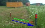
- Indicates the boundaries of the site on the ground.
The engineer fills out the act of approving the location of the boundaries ( download the form ). Moreover, on its other side there must be a drawing of the site. A sample agreement on land surveying is available for review on our website.
Read more >> How to correctly draw up an act of approval of the boundaries of a land plot .
The owners of the adjacent territories themselves must have a passport, powers of attorney certified by a notary and documents for the land. The latter may not be brought if the rights to the land are already in the Unified State Register of Real Estate.
Neighbors disagree
A neighbor’s disagreement with the surveying of a plot or land plots may be revealed already at the preliminary stage, that is, when he is given a notice. He may simply refuse to take it. But you need to remember that in this case it will be considered that he was notified.
Borders are considered agreed upon only if all owners of adjacent territories add their signatures to the act. The document also records the passport details of neighbors or those who represent them.
There are situations when the land will be considered with the agreed boundary and without the consent of the neighbors. But for this the following conditions must be met:
- the owner or his authorized representative is duly informed about the approval;
- he did not sign the document as a sign of consent;
- he did not write a written disagreement with the location of the site boundaries.
All these facts must be recorded in the act. If the owner of the adjacent land expressed disagreement in writing with the proposed boundaries of the site, then such data should certainly be included in the act.
If the consent of the neighbors cannot be achieved even after re-approval, the only thing left to do is go to court. Rights holders of neighboring lands can also challenge the established boundaries in court.
Court
There are many examples in judicial practice when boundaries are defined and agreed upon without the approval of all owners of adjacent plots. And the court examines all the circumstances due to which the neighbors’ opinions were not taken into account.
Read also >> How disputes between neighbors are resolved when land surveying occurs .
If they were notified on time (and evidence of timely and correct notification is attached to the boundary plan), but they did not react in any way - did not agree or object - then, usually, the established boundaries are left unchanged.
The initiator of boundary procedures can also file a lawsuit. The defendants are the neighbors who do not sign the act, and the third parties are the cadastral engineer and Rosreestr.
Requirements in court may be different:
- admit that the boundaries of the adjacent site are located incorrectly due to an error in the Unified State Register of Real Estate ;
- establish boundaries between land plots.
The following documents must be submitted to the court:
- statement of claim and its copies. There must be as many of them as there are defendants and third parties;
- copies of documents that allow you to own land, an extract from the Unified State Register of Real Estate;
- a copy of the boundary plan;
- data from the Unified State Register of Real Estate about the border area.
In addition, you need to clarify the amount of the state duty and then add a receipt for its payment to the package of documents. The claim should be filed at the location of the site.
People cannot always correctly formulate their claims in a statement of claim, but this is very important. If they are expressed incorrectly, the judge may reject the claim due to incorrect wording. Our lawyers know how to correctly state their requirements and are ready to help you with this.
Terms of consideration
Notice of the meeting must be delivered to the rights holders of adjacent plots or published at least a month before the meeting itself.